
The municipality of Messines is located in the Outaouais administrative region, more precisely in the heart of the Vallée-de-la-Gatineau, about 115 kilometers north of the Canadian capital and about 20 kilometers south of the City of Maniwaki. With an area of more than 108 square kilometers, it is inhabited by more than 1680 Messinoise and Messinois, which makes it the fourth largest in the Gatineau Valley. The natural and enchanting scenery and the cleanliness of the area have earned the municipality the title of Fleur de la Gatineau.
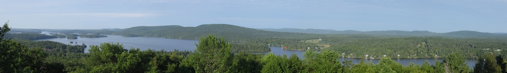
A popular destination for thousands of vacationers, it offers privileged access to the magnificent Blue Sea Lake and many other bodies of water that cover one third of its territory. Boat ramps are available on the three main lakes of the municipality, Petit lac-des-Cèdres, Grand lacs des cèdres and Blue Sea Lake. The beauty of the Cedar Lakes area must not be overlooked, as it offers visitors beautiful trails to discover both in summer and winter.
Messines is home to SOPFEU's control center for the southwestern Quebec territory. From its offices located at the Maniwaki regional airport, SOPFEU ensures the monitoring and fighting of forest fires on a vast territory that extends from the north of Montreal to Témiscamingue.
A little history
The beginnings of the municipality date back to 1850 when one of Jos Montferrand's lieutenants, Pierre Guertin, settled in Upper Gatineau, in the area that is still known today as Val-Guertin. At that time, Messines was part of the territory of the Township of Bouchette and was known as the Burbidge sector. This area was named after the Canadian Deputy Minister of Justice, George Wheelock Burbidge (1847-1908), one of the Crown's lawyers in the trial of the Métis Louis Riel, and owner of a cottage along Blue Sea Lake.
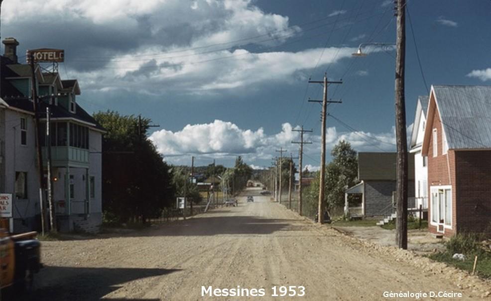
The Burbidge area was able to develop through agriculture and the exploitation of the forests that covered the territory. However, it was the arrival of the railroad that contributed to the development of the community and allowed it to prosper.
In 1921, the Burbridge sector was detached from Bouchette to form the new Municipality of Messines, whose first mayor was Louis Lécuyer. Messines is named after a Belgian village in West Flanders called Mesen or Meesen in Dutch where Canadians fought in the First World War. This place is located on the border with France, a few kilometers from Ypres, a witness to the valour and courage of our people. In the letters patent of the new municipality, a transcription error caused the loss of the final "S" in the name of Messines, a situation that was only rectified in 1986.
In those early days, the people of Messines discovered that the sandy soils of the region were ideal for extensive potato farming. This sector of agriculture became the main source of income for the municipality. Later, towards the end of the 20th century, Messines gradually turned to tourism and vacationing.
Today, the municipality is recognized as a favourite place for hunting, fishing and various four-season tourist activities. It also has access to the paved portion of the Gatineau Valley Linear Park.
Source :